| |
 Discover Discover |
 Reveal Reveal |
| Vector Charts |
|
|
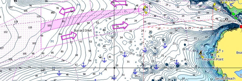
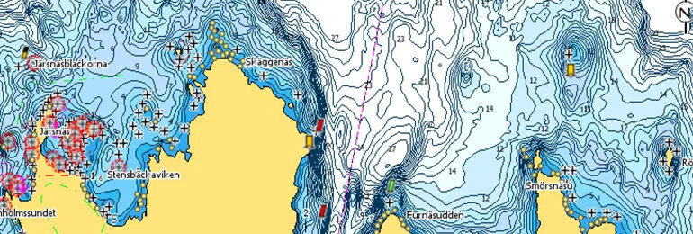
Full Featured Vector charts make navigation easy by giving you accurate, up-to-date vector chart detail derived from official Hydrographic Office information. |
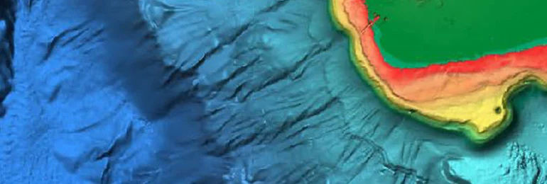
| High Resolution Bathymetry |
|
|
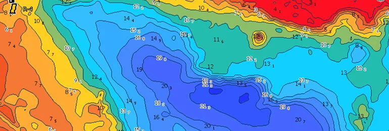
High-Res Bathy helps you identify shallow areas, drop offs, ledges, holes or humps by accurate contour lines down to 1-foot level of detail. Includes the very best of C-MAP HRB data, including C-MAP Team Lake Surveys (US only) and Genesis® social maps, quality controlled and fully integrated. |
| Genesis Data |
|
|
| Get Crowd-Sourced Genesis data from all arround the world by downloading selected regions onto you C-Map chart. |
| Custom Depth Shading |
|
|
Custom Depth Shading allows you to set a safety depth, maintain a paper-like view or set your own custom shading – see things your way. |
| Free Easy-Routing |
|
|
Easy Routing helps you automatically plot the shortest, safest route based on detailed chart data and your personalized vessel information. With C-MAP Easy Routing is always subscription free. |
| Tides & Currents |
|
|
Tides & Currents show projections of water level and direction of tides to help plan your day out, whether cruising, angling or sailing. *only available with Coastal charts |
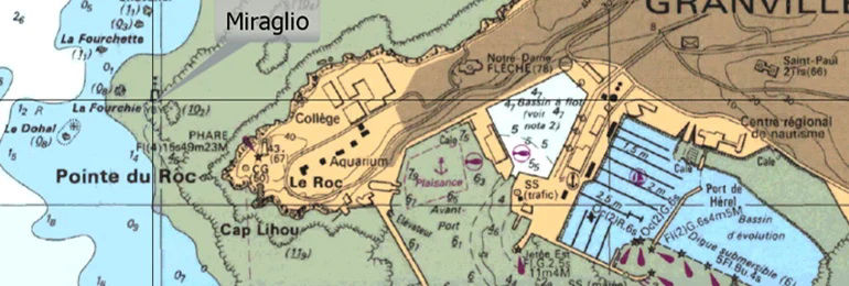
| Detailed Marine Port Plans |
|
|
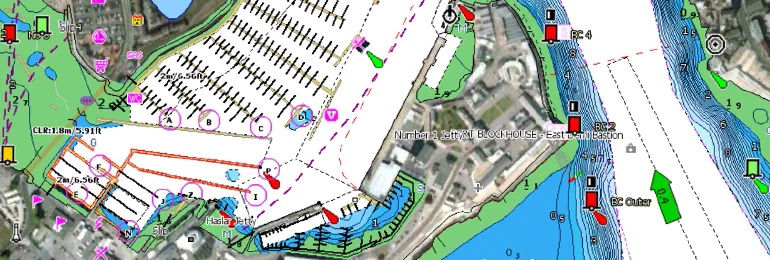
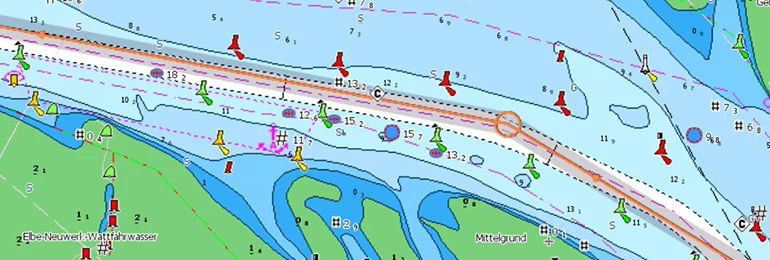
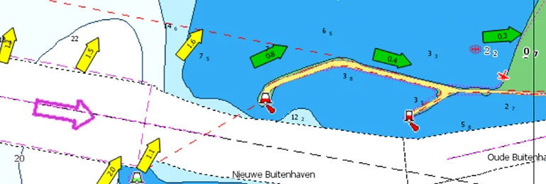
Docking in an unfamiliar port is no problem, when you have precise layouts of thousands of marinas, including slip spaces, restricted areas, and other valuable navigation information. |
| Multi-Language |
|
|
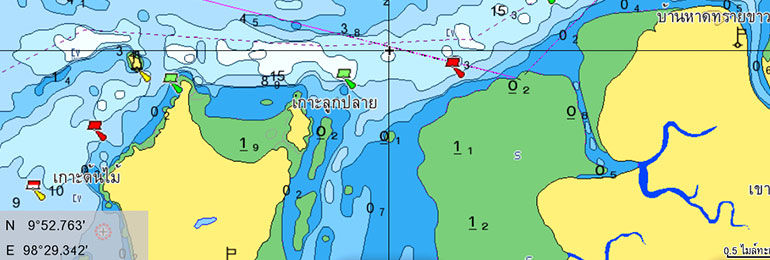
Supports map names in local language, such as Thai (The language your MFD is set to will determine which language is shown on the map, if it's available for that region). |
| 12-Months Free Online Updates |
|
|
| Register an account with C-Map and get free updates for your C-Map Reveal or C-Map Discover charts for 1 year by downloading latest updates. |
| Raster Charts |
|
|
Providing the traditional chart look and feel, coupled with easy access to all objects on the chart. |
| Satellite Imagery |
|
|
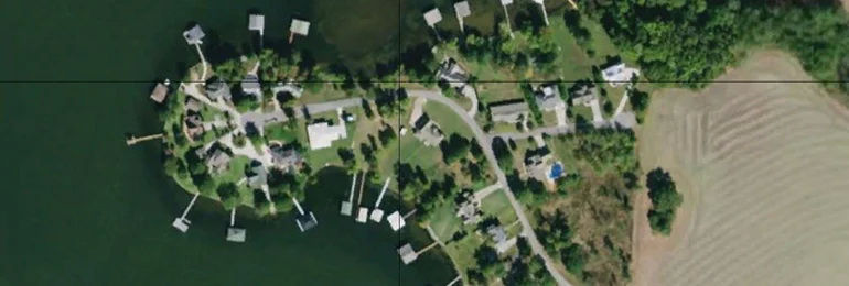
Satellite imagery gives information about the surroundings when you find yourself in an unfamiliar place. |
| Shaded Relief-3D |
|
|
Bring the world around you to life, with 3D rendered land and underwater elevation – including areas of Ultra-High Res Bathymetric imagery previously only available in MAX-N+ Reveal – a game-changer for anglers and divers. |
| |
|
|


")